Our Coverage Area
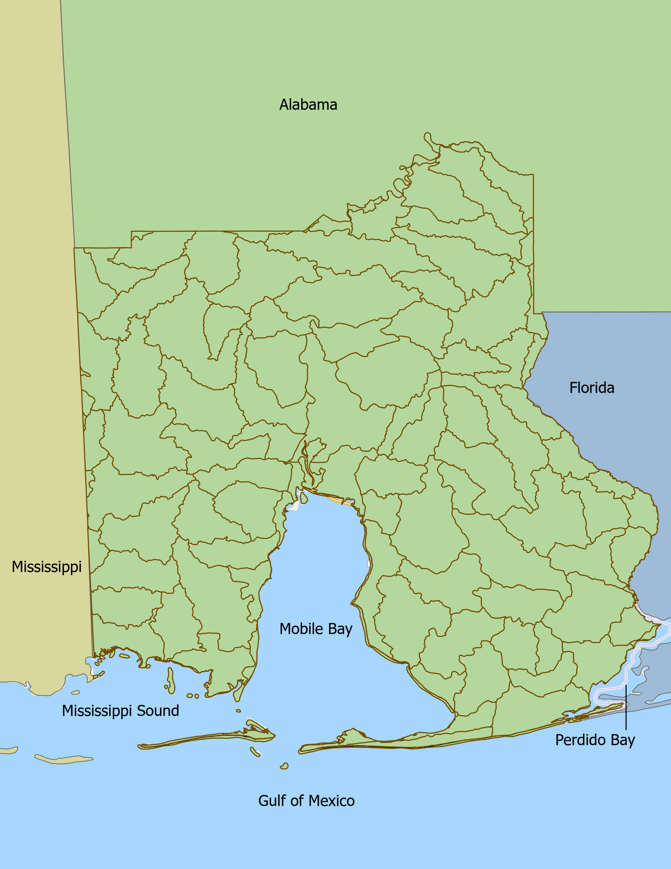
Coverage Area Map of MBNEP
The Mobile Bay Estuary Program coverage area includes waters within Baldwin and Mobile Counties and Mobile Bay from the west at the Mississippi state line to the east at the Florida state line, terminating at the Perdido River. This estuary is greatly affected by upstream waters that flow into it from the expansive Mobile Bay Watershed. Other coastal estuaries in and near Alabama include Mississippi Sound westward to the Alabama-Mississippi State Line, Perdido Bay, and their tributaries. The Mobile Bay National Estuary Program service area includes all of Mobile and Baldwin Counties, as well as Alabama State marine waters in the north central Gulf of Mexico, extending three miles south of Dauphin Island and the Fort Morgan Peninsula. The Mobile Bay National Estuary Program study area is shown on the map.


