The Landscape
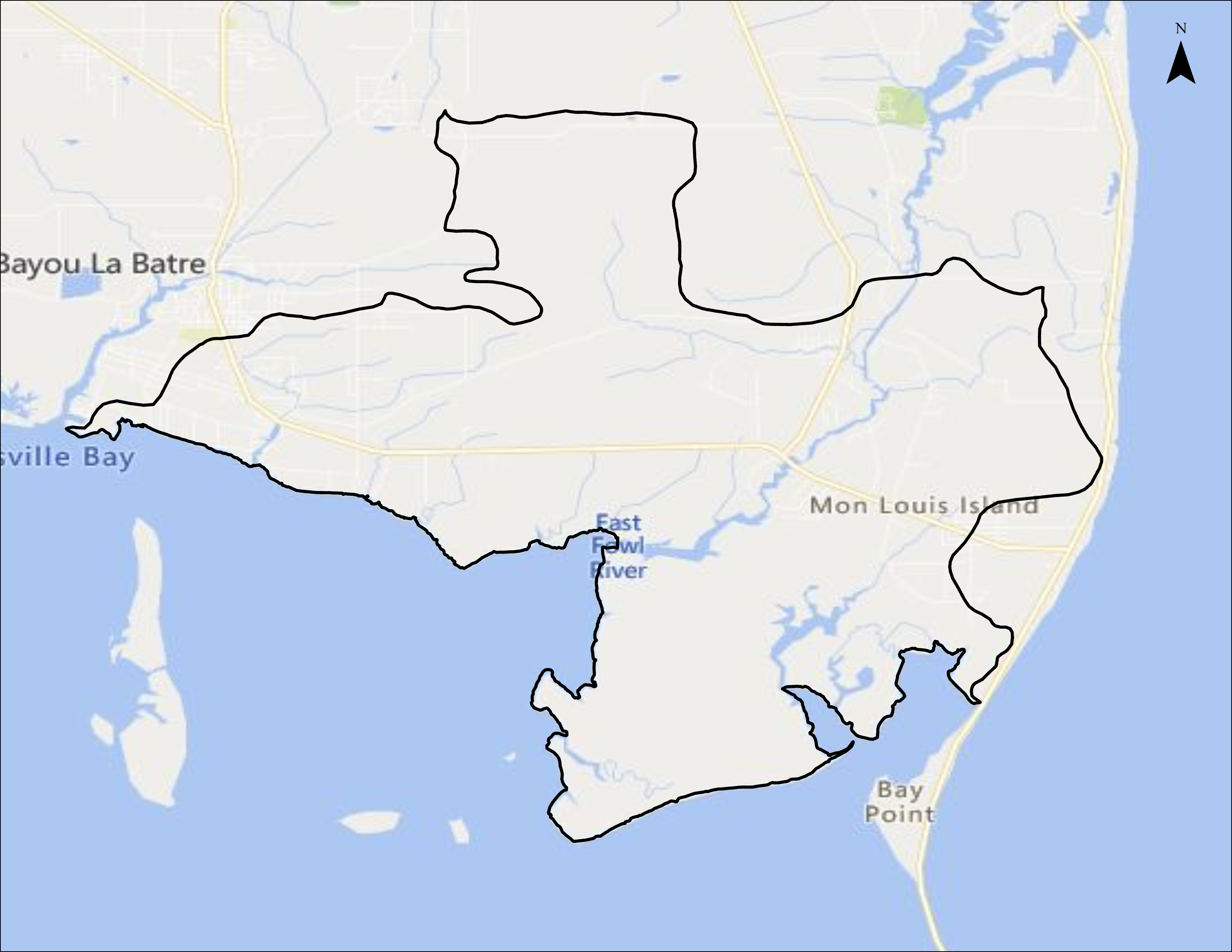
Watershed Size and Location
The West Fowl River Watershed covers approximately 20,489 acres (USGS 2013), is located in the Escatawpa River Basin, and forms in southern Mobile County. It comprises several named tributary systems including: Bayou Coden, Bayou Como, Bayou Jonas, Bayou Sullivan, Heron Bayou, the ‘Narrows,’ Negro Bayou, and West Fowl River. All of these named tributary systems receive drainage from multiple unnamed tributaries, a common trait of tidally-influenced coastal stream network systems. According to the National Hydrography Database (NHD) flowlines data (USGS 2013), the cumulative stream network system of the West Fowl River Watershed is approximately 112.2 miles long.
According to the National Land Cover Database 2011 (Homer et al., 2015), the land use and land cover within the West Fowl River Watershed is primarily characterized by four classifications: non-woody wetland (34%), woody wetland (39%), upland forest (13%) and urban (6%). These three classifications total 92% of the land use and land cover of the West Fowl River Watershed.
Main Tributaries and Tidal Influence
West Fowl River, the largest tributary in the West Fowl River Watershed, is a shallow, tidally influenced river that receives drainage from Bayou Jonas, the ‘Narrows,’ and multiple unnamed tributaries. West Fowl River was originally known by the name ‘Fowl River’ which is thought to have been named by the original French colonists who referred to it as the ‘Riviere aux Poules’ (Ware 1982). It is unknown when Fowl River was first specified into ‘East Fowl River’ and ‘West Fowl River’, but this nomenclature reflects the knowledge that a portion of Fowl River system flows north and east entering into Mobile Bay (East Fowl River), while the southern portion, south of the ‘Narrows,’ typically flows south and west (West Fowl River) and enters into the Mississippi Sound through Fowl River Bay and Portersville Bay. The total length of West Fowl River contained within the Watershed boundary is 4.6 miles (USGS 2013) and has use classifications of Swimming & Other Whole Body Water-Contact Sports and Fish & Wildlife (ADEM 2014). Bayou Coden is 2.3 miles long and has a use classification of Fish & Wildlife (ADEM 2014).
Water Use Classification and Impairments
ADEM classifies West Fowl River for use as Swimming & Whole Body Contact, as well as Fish & Wildlife. West Fowl River has been listed on the 303(d) list of impaired waters since 2000 for Metals (Mercury). A draft TMDL was originally expected in 2018 but has been delayed until 2020 on the draft 2014 list. The listed cause of this impairment is atmospheric deposition.
Human Uses
Access to the waterways along West Fowl River includes private access points, including Jemison’s Bait and Tackle boat launch and Delta Port Marina. Additional access points are needed. The immediate inshore waters surrounding the watershed have historically supported both public oyster reefs and private leased beds. Currently, the area supports 5 commercial off-bottom oyster farms that provided a harvest of ~200,000 oysters at a wholesale value of ~$100,000 during the previous production cycle. The area is likely to add 3 more farms and annual production could increase to over 1.2 million oysters per year with a wholesale value of ~$500,000.
Ecological Importance
ADCNR has identified the West Fowl River area as a Geographical Area of Particular Concern (GAPC). This designation defines Special Management Areas within the coastal region that warrant special attention because of their coastal related values, characteristics or specific pressures. The area contains a wide array of natural communities and species regarded as rare in coastal Alabama. USFWS documented T&E Species: Florida manatee (Trichechus manatus latirostris) and Gulf sturgeon (Acipenser oxyrinchus desotoi) have been found in West Fowl River. State protected species include the Mississippi diamondback terrapin (Malaclemys terrapin pileata) and alligator snapping turtle (Macroclemys temmincki).


